
Thank you for supporting this site ❤️
Make a donation
Make a donation
Gear up for your next adventure:
As an Amazon Associate, this site earns from qualifying purchases at no extra cost to you.
Chicavasco topographic map
Click on the map to display elevation.
Thank you for supporting this site ❤️
Make a donation
Make a donation
Gear up for your next adventure:
As an Amazon Associate, this site earns from qualifying purchases at no extra cost to you.
About this map
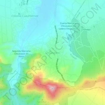
Name: Chicavasco topographic map, elevation, terrain.
Location: Chicavasco, Actopan, Hidalgo, 42601, México (20.17535 -98.97414 20.21535 -98.93414)
Average elevation: 2,091 m
Minimum elevation: 1,998 m
Maximum elevation: 2,346 m
Thank you for supporting this site ❤️
Make a donation
Make a donation
Gear up for your next adventure:
As an Amazon Associate, this site earns from qualifying purchases at no extra cost to you.