
Thank you for supporting this site ❤️
Make a donation
Make a donation
Gear up for your next adventure:
As an Amazon Associate, this site earns from qualifying purchases at no extra cost to you.
Lastovo topographic map
Click on the map to display elevation.
Thank you for supporting this site ❤️
Make a donation
Make a donation
Gear up for your next adventure:
As an Amazon Associate, this site earns from qualifying purchases at no extra cost to you.
About this map
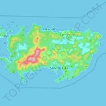
Name: Lastovo topographic map, elevation, terrain.
Location: Lastovo, Općina Lastovo, Dubrovnik-Neretva County, Croatia (42.72292 16.81183 42.77804 16.94320)
Average elevation: 35 m
Minimum elevation: 0 m
Maximum elevation: 409 m
Thank you for supporting this site ❤️
Make a donation
Make a donation
Gear up for your next adventure:
As an Amazon Associate, this site earns from qualifying purchases at no extra cost to you.