Geolocate

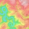
Bastogne topographic map

Click on the map to display elevation.

Bastogne

The municipality consists of the following districts: Bastogne, Longvilly, Noville, Villers-la-Bonne-Eau, and Wardin. The town is situated on a ridge in the Ardennes at an elevation of 510 metres (1,670 ft).

Wikipedia (CC-BY-SA 3.0)

About this map

Name: Bastogne topographic map, elevation, terrain.

Location: Bastogne, Luxembourg, Wallonia, Belgium (49.90936 5.53836 50.11722 5.86993)

Average elevation: 464 m

Minimum elevation: 282 m

Maximum elevation: 562 m

Other topographic maps

Click on a map to view its topography, its elevation and its terrain.

Provedroux

Belgium > Luxembourg > Bastogne

Average elevation: 468 m

Ollomont

Belgium > Luxembourg > Bastogne > Houffalize

Average elevation: 376 m

Fin de Ville

Belgium > Luxembourg > Bastogne > Houffalize

Average elevation: 403 m

Bastogne

Belgium > Luxembourg > Bastogne > Bastogne

The municipality consists of the following districts: Bastogne, Longvilly, Noville, Villers-la-Bonne-Eau, and Wardin. The town is situated on a ridge in the Ardennes at an elevation of 510 metres (1,670 ft).

Average elevation: 505 m

Assenois

Belgium > Luxembourg > Bastogne

Average elevation: 511 m

Foy

Belgium > Luxembourg > Bastogne > Bastogne

Average elevation: 506 m

Bertogne

Belgium > Luxembourg > Bastogne > Bastogne

Average elevation: 424 m

Fraiture

Belgium > Luxembourg > Bastogne

Average elevation: 569 m

Sainte-Ode

Belgium > Luxembourg > Bastogne

Average elevation: 418 m

Ennal

Belgium > Luxembourg > Bastogne

Average elevation: 418 m

Alhoumont

Belgium > Luxembourg > Bastogne > Houffalize

Average elevation: 426 m

Baraque de Fraiture

Belgium > Luxembourg > Bastogne > Vielsalm

Average elevation: 610 m

Wathermal

Belgium > Luxembourg > Bastogne > Gouvy

Average elevation: 489 m

Provedroux

Belgium > Luxembourg > Bastogne

Average elevation: 468 m

Ollomont

Belgium > Luxembourg > Bastogne > Houffalize > Nadrin

Average elevation: 376 m

Baraque de Fraiture

Belgium > Luxembourg > Bastogne > Vielsalm

Average elevation: 610 m

Gear up for your next adventure:

🧥Packable Down Jackets - Lightweight warmth that compresses small in your bag
🗺️Topographic Maps - Detailed maps showing elevation and terrain features
🎒Hiking Daypacks - Compact backpacks ideal for short hikes and excursions
🗺️Ordnance Survey Maps - Official UK maps for walking and outdoor activities
🥾Walking Shoes - Lightweight walking shoes for countryside and coastal paths

As an Amazon Associate, this site earns from qualifying purchases at no extra cost to you.