Geolocate

Mohanpur topographic map

Click on the map to display elevation.

About this map

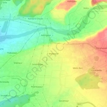
Name: Mohanpur topographic map, elevation, terrain.

Location: Mohanpur, Dehradun, Uttarakhand, 248001, India (30.31262 77.93792 30.35262 77.97792)

Average elevation: 599 m

Minimum elevation: 557 m

Maximum elevation: 647 m

Gear up for your next adventure:

🧤Thermal Touchscreen Gloves - Stay warm while operating your GPS or smartphone camera
🕶️Glacier Goggles - Maximum protection for high-altitude snow topography
🥾Women's Waterproof Hiking Boots - High-performance trekking boots designed for all-weather comfort
👟Women's Trail Running Shoes - Agile footwear for fell running and technical trails
🎒Hiking Daypacks - Compact backpacks ideal for short hikes and excursions

As an Amazon Associate, this site earns from qualifying purchases at no extra cost to you.