
Puente de Ixtla topographic map
Interactive map
Click on the map to display elevation.
About this map
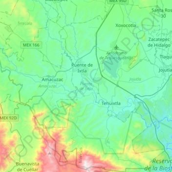
Name: Puente de Ixtla topographic map, elevation, terrain.
Location: Puente de Ixtla, Morelos, Mexique (18.45100 -99.38014 18.72436 -99.17592)
Average elevation: 1,079 m
Minimum elevation: 763 m
Maximum elevation: 2,275 m
Other topographic maps
Click on a map to view its topography, its elevation and its terrain.
Cuernavaca
Mexique > Morelos > Cuernavaca
Cuernavaca, Morelos, 62000, Mexique
Average elevation: 1,822 m