
Otomin topographic map
Interactive map
Click on the map to display elevation.
About this map
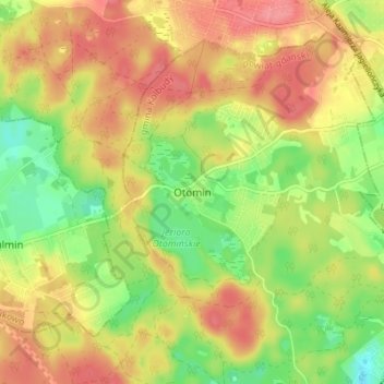
Name: Otomin topographic map, elevation, terrain.
Average elevation: 128 m
Minimum elevation: 88 m
Maximum elevation: 160 m
Other topographic maps
Click on a map to view its topography, its elevation and its terrain.
Borkowo
Poland > Pomeranian Voivodeship > Gdańsk County
Borkowo, gmina Pruszcz Gdański, Gdańsk County, Pomeranian Voivodeship, Poland
Average elevation: 67 m
Kiezmark
Poland > Pomeranian Voivodeship > Gdańsk County
Kiezmark, gmina Cedry Wielkie, Gdańsk County, Pomeranian Voivodeship, Poland
Average elevation: 1 m
Pruszcz Gdański
Poland > Pomeranian Voivodeship > Gdańsk County > Pruszcz Gdański
Pruszcz Gdański, Gdańsk County, Pomeranian Voivodeship, Poland
Average elevation: 11 m
Wypychy
Poland > Pomeranian Voivodeship > Gdańsk County > Buszkowy
Wypychy, Buszkowy, gmina Kolbudy, Gdańsk County, Pomeranian Voivodeship, Poland
Average elevation: 193 m
Mierzeszyn
Poland > Pomeranian Voivodeship > Gdańsk County
Mierzeszyn, gmina Trąbki Wielkie, Gdańsk County, Pomeranian Voivodeship, 83-041, Poland
Average elevation: 208 m