Geolocate

Layhill topographic map

Click on the map to display elevation.

About this map

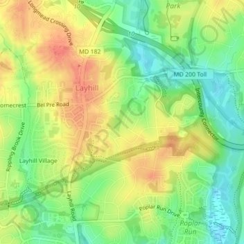
Name: Layhill topographic map, elevation, terrain.

Location: Layhill, Montgomery County, Maryland, United States (39.07740 -77.05592 39.09963 -77.02388)

Average elevation: 112 m

Minimum elevation: 86 m

Maximum elevation: 137 m

Gear up for your next adventure:

🧰Survival Kits - Emergency tools for remote environments
🧘Folding Sit Mats - Dry and warm seat for map-reading breaks on damp ground
🚲Bikepacking Frame Bags - Storage for tools and navigation gear on long off-road rides
📦Compression Sacks - Reduce backpack volume efficiently
🔋Solar Power Banks - Keep your GPS and phone charged during multi-day expeditions

As an Amazon Associate, this site earns from qualifying purchases at no extra cost to you.