
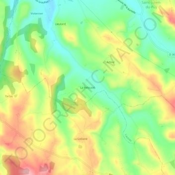
La Pelousié topographic map
Interactive map
Click on the map to display elevation.
About this map
Name: La Pelousié topographic map, elevation, terrain.
Average elevation: 236 m
Minimum elevation: 173 m
Maximum elevation: 314 m
Other topographic maps
Click on a map to view its topography, its elevation and its terrain.
Les Martys
France > Occitanie > Tarn > Saint-Julien-du-Puy > Les Martys
Les Martys, Saint-Julien-du-Puy, Castres, Tarn, Occitanie, France métropolitaine, 81440, France
Average elevation: 204 m
La Bartelle
France > Occitanie > Tarn > Saint-Julien-du-Puy
La Bartelle, Saint-Julien-du-Puy, Castres, Tarn, Occitanie, France métropolitaine, 81440, France
Average elevation: 208 m