
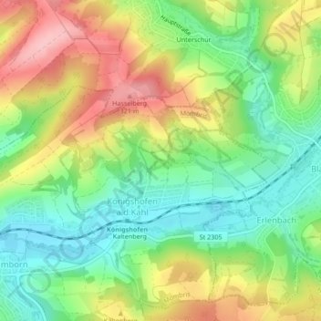
Königshofen an der Kahl topographic map
Interactive map
Click on the map to display elevation.
About this map
Name: Königshofen an der Kahl topographic map, elevation, terrain.
Average elevation: 241 m
Minimum elevation: 174 m
Maximum elevation: 330 m
Other topographic maps
Click on a map to view its topography, its elevation and its terrain.
Daxberg
Deutschland > Bayern > Landkreis Aschaffenburg > Mömbris
Daxberg, Mömbris, Landkreis Aschaffenburg, Bayern, Deutschland
Average elevation: 268 m