Geolocate

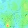
Mutãs topographic map

Click on the map to display elevation.

About this map

Name: Mutãs topographic map, elevation, terrain.

Location: Mutãs, Guanambi, Bahia, Região Nordeste, Brasil (-14.39615 -43.07005 -14.09715 -42.88514)

Average elevation: 592 m

Minimum elevation: 472 m

Maximum elevation: 1,246 m

Other topographic maps

Click on a map to view its topography, its elevation and its terrain.

Sertão

Brasil > Bahia > Guanambi

Average elevation: 567 m

Fazenda Caiçara

Brasil > Bahia > Guanambi > Fazenda Caiçara

Average elevation: 518 m

Lagoa de João Amaral

Brasil > Bahia > Guanambi

Average elevation: 529 m

Laranja

Brasil > Bahia > Guanambi

Average elevation: 572 m

Gado Bravo

Brasil > Bahia > Guanambi

Average elevation: 889 m

Campo de Cima

Brasil > Bahia > Guanambi

Average elevation: 512 m

Poço Comprido

Brasil > Bahia > Guanambi

Average elevation: 532 m

Gear up for your next adventure:

📕Outdoor Navigation Books - Learn traditional and modern navigation techniques
📷Outdoor Action Cameras - Cameras designed for hiking and adventure
⌚GPS Outdoor Watches - Watches with GPS tracking for hiking and exploration
🦟Anti-Midge & Tick Repellent - Vital for hiking in the Scottish Highlands during summer
🥫Expedition Meals - Lightweight, high-calorie nutrition for long-distance hikers

As an Amazon Associate, this site earns from qualifying purchases at no extra cost to you.