
Warta River Mouth National Park topographic map
Interactive map
Click on the map to display elevation.
About this map
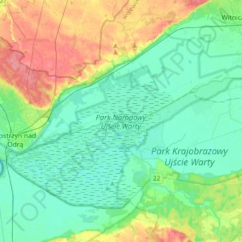
Name: Warta River Mouth National Park topographic map, elevation, terrain.
Average elevation: 27 m
Minimum elevation: 7 m
Maximum elevation: 77 m
Other topographic maps
Click on a map to view its topography, its elevation and its terrain.
Lubniewice
Poland > Lubusz Voivodeship > Sulęcin County
Lubniewice, gmina Lubniewice, Sulęcin County, Lubusz Voivodeship, 69-210, Poland
Average elevation: 70 m