
Bastam topographic map
Interactive map
Click on the map to display elevation.
About this map
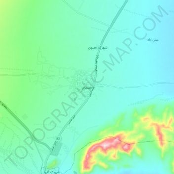
Name: Bastam topographic map, elevation, terrain.
Average elevation: 1,434 m
Minimum elevation: 1,361 m
Maximum elevation: 1,735 m
Other topographic maps
Click on a map to view its topography, its elevation and its terrain.
خرقان
Iran > Semnan Province > Shahrud County > دهستان خرقان
خرقان, دهستان خرقان, بخش بسطام, Shahrud County, Semnan Province, Iran
Average elevation: 1,514 m