
Thank you for supporting this site ❤️
Make a donation
Make a donation
Gear up for your next adventure:
As an Amazon Associate, this site earns from qualifying purchases at no extra cost to you.
Moulbaix topographic map
Click on the map to display elevation.
Thank you for supporting this site ❤️
Make a donation
Make a donation
Gear up for your next adventure:
As an Amazon Associate, this site earns from qualifying purchases at no extra cost to you.
About this map
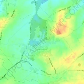
Name: Moulbaix topographic map, elevation, terrain.
Location: Moulbaix, Ath, Hainaut, Wallonia, Belgium (50.58950 3.68997 50.61560 3.73171)
Average elevation: 51 m
Minimum elevation: 35 m
Maximum elevation: 72 m
Thank you for supporting this site ❤️
Make a donation
Make a donation
Gear up for your next adventure:
As an Amazon Associate, this site earns from qualifying purchases at no extra cost to you.