
Make a donation
Gear up for your next adventure:
As an Amazon Associate, this site earns from qualifying purchases at no extra cost to you.
Gallatin topographic map
Click on the map to display elevation.
Make a donation
Gear up for your next adventure:
As an Amazon Associate, this site earns from qualifying purchases at no extra cost to you.
About this map
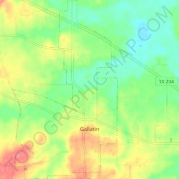
Name: Gallatin topographic map, elevation, terrain.
Location: Gallatin, Cherokee County, Texas, 75764, United States (31.87609 -95.17274 31.92958 -95.13564)
Average elevation: 103 m
Minimum elevation: 73 m
Maximum elevation: 144 m
Make a donation
Gear up for your next adventure:
As an Amazon Associate, this site earns from qualifying purchases at no extra cost to you.
Other topographic maps
Click on a map to view its topography, its elevation and its terrain.
Jacksonville
United States > Texas > Cherokee County > Jacksonville > Jacksonville
Average elevation: 154 m
Make a donation
Gear up for your next adventure:
As an Amazon Associate, this site earns from qualifying purchases at no extra cost to you.