
Jevnaker topographic map
Interactive map
Click on the map to display elevation.
About this map
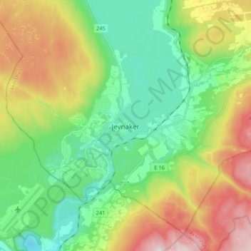
Name: Jevnaker topographic map, elevation, terrain.
Location: Jevnaker, Akershus, 3520, Norwegen (60.20104 10.34551 60.28104 10.42551)
Average elevation: 282 m
Minimum elevation: 76 m
Maximum elevation: 660 m
Other topographic maps
Click on a map to view its topography, its elevation and its terrain.