
O Picato topographic map
Interactive map
Click on the map to display elevation.
About this map
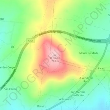
Name: O Picato topographic map, elevation, terrain.
Location: O Picato, Lugo, Galicia, 27210, España (42.93486 -7.64830 42.93496 -7.64820)
Average elevation: 650 m
Minimum elevation: 566 m
Maximum elevation: 780 m
Other topographic maps
Click on a map to view its topography, its elevation and its terrain.