
Thank you for supporting this site ❤️
Make a donation
Make a donation
Gear up for your next adventure:
As an Amazon Associate, this site earns from qualifying purchases at no extra cost to you.
Pinquiray topographic map
Click on the map to display elevation.
Thank you for supporting this site ❤️
Make a donation
Make a donation
Gear up for your next adventure:
As an Amazon Associate, this site earns from qualifying purchases at no extra cost to you.
About this map
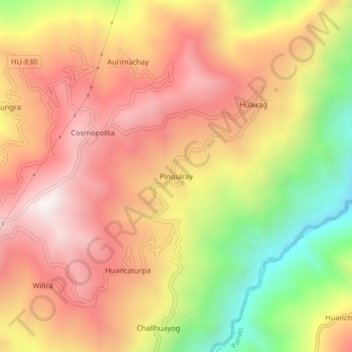
Name: Pinquiray topographic map, elevation, terrain.
Location: Pinquiray, Umari, Provincia de Pachitea, Huánuco, Perú (-9.86685 -75.98382 -9.82685 -75.94382)
Average elevation: 2,704 m
Minimum elevation: 2,083 m
Maximum elevation: 3,153 m
Thank you for supporting this site ❤️
Make a donation
Make a donation
Gear up for your next adventure:
As an Amazon Associate, this site earns from qualifying purchases at no extra cost to you.