
Le Soulier topographic map
Interactive map
Click on the map to display elevation.
About this map
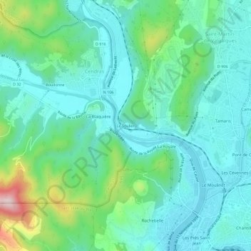
Name: Le Soulier topographic map, elevation, terrain.
Average elevation: 202 m
Minimum elevation: 125 m
Maximum elevation: 466 m
Other topographic maps
Click on a map to view its topography, its elevation and its terrain.
La Vabreille
France > Occitanie > Gard > Saint-Martin-de-Valgalgues > La Vabreille
La Vabreille, Saint-Martin-de-Valgalgues, Alès, Gard, Occitanie, France métropolitaine, 30520, France
Average elevation: 223 m