
Thank you for supporting this site ❤️
Make a donation
Make a donation
Gear up for your next adventure:
As an Amazon Associate, this site earns from qualifying purchases at no extra cost to you.
Reichenbach topographic map
Click on the map to display elevation.
Thank you for supporting this site ❤️
Make a donation
Make a donation
Gear up for your next adventure:
As an Amazon Associate, this site earns from qualifying purchases at no extra cost to you.
About this map
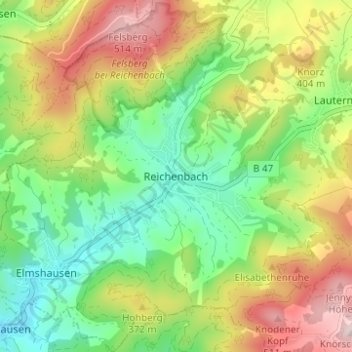
Name: Reichenbach topographic map, elevation, terrain.
Location: Reichenbach, Lautertal, Kreis Bergstraße, Hesse, 64686, Germany (49.69285 8.67283 49.73285 8.71283)
Average elevation: 314 m
Minimum elevation: 160 m
Maximum elevation: 537 m
Thank you for supporting this site ❤️
Make a donation
Make a donation
Gear up for your next adventure:
As an Amazon Associate, this site earns from qualifying purchases at no extra cost to you.