
Thank you for supporting this site ❤️
Make a donation
Make a donation
Gear up for your next adventure:
As an Amazon Associate, this site earns from qualifying purchases at no extra cost to you.
08289 topographic map
Click on the map to display elevation.
Thank you for supporting this site ❤️
Make a donation
Make a donation
Gear up for your next adventure:
As an Amazon Associate, this site earns from qualifying purchases at no extra cost to you.
About this map
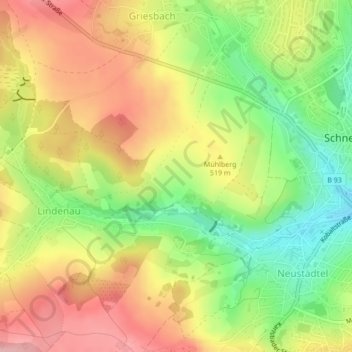
Name: 08289 topographic map, elevation, terrain.
Location: 08289, Griesbach, Schneeberg, Erzgebirgskreis, Saxony, Germany (50.59209 12.62019 50.59219 12.62029)
Average elevation: 505 m
Minimum elevation: 430 m
Maximum elevation: 574 m
Thank you for supporting this site ❤️
Make a donation
Make a donation
Gear up for your next adventure:
As an Amazon Associate, this site earns from qualifying purchases at no extra cost to you.