
Trögelsbach topographic map
Interactive map
Click on the map to display elevation.
About this map
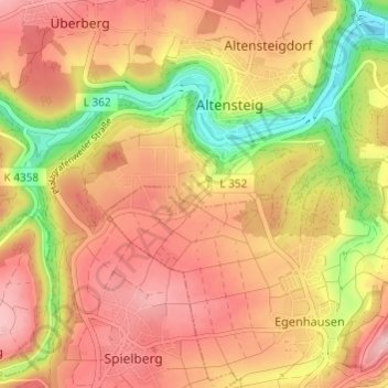
Name: Trögelsbach topographic map, elevation, terrain.
Average elevation: 545 m
Minimum elevation: 434 m
Maximum elevation: 618 m
Other topographic maps
Click on a map to view its topography, its elevation and its terrain.
Monhardt
Deutschland > Baden-Württemberg > Landkreis Calw > Altensteig
Monhardt, Altensteig, Verwaltungsgemeinschaft Altensteig, Landkreis Calw, Baden-Württemberg, 72224, Deutschland
Average elevation: 524 m