
Żagań topographic map
Interactive map
Click on the map to display elevation.
About this map
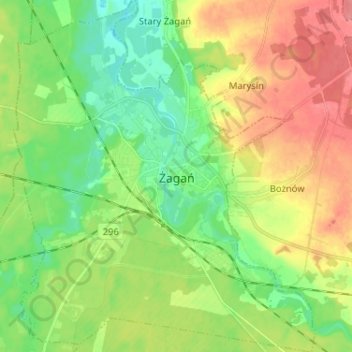
Name: Żagań topographic map, elevation, terrain.
Location: Żagań, Żagań County, Lubusz Voivodeship, 68-100, Poland (51.57487 15.26030 51.65500 15.37116)
Average elevation: 119 m
Minimum elevation: 90 m
Maximum elevation: 159 m