
Thank you for supporting this site ❤️
Make a donation
Make a donation
Gear up for your next adventure:
As an Amazon Associate, this site earns from qualifying purchases at no extra cost to you.
Petatán topographic map
Click on the map to display elevation.
Thank you for supporting this site ❤️
Make a donation
Make a donation
Gear up for your next adventure:
As an Amazon Associate, this site earns from qualifying purchases at no extra cost to you.
About this map
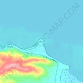
Name: Petatán topographic map, elevation, terrain.
Location: Petatán, Cojumatlán de Régules, Michoacán, México (20.14132 -102.88671 20.18132 -102.84671)
Average elevation: 1,539 m
Minimum elevation: 1,515 m
Maximum elevation: 1,676 m
Thank you for supporting this site ❤️
Make a donation
Make a donation
Gear up for your next adventure:
As an Amazon Associate, this site earns from qualifying purchases at no extra cost to you.