
Thank you for supporting this site ❤️
Make a donation
Make a donation
Gear up for your next adventure:
As an Amazon Associate, this site earns from qualifying purchases at no extra cost to you.
Umuttepe topographic map
Click on the map to display elevation.
Thank you for supporting this site ❤️
Make a donation
Make a donation
Gear up for your next adventure:
As an Amazon Associate, this site earns from qualifying purchases at no extra cost to you.
About this map
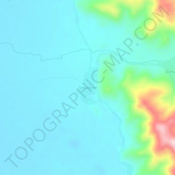
Name: Umuttepe topographic map, elevation, terrain.
Location: Umuttepe, Çaldıran, Van, Eastern Anatolia Region, Turkey (39.10583 44.04185 39.14583 44.08185)
Average elevation: 2,097 m
Minimum elevation: 2,047 m
Maximum elevation: 2,354 m
Thank you for supporting this site ❤️
Make a donation
Make a donation
Gear up for your next adventure:
As an Amazon Associate, this site earns from qualifying purchases at no extra cost to you.