
Blackwater topographic map
Interactive map
Click on the map to display elevation.
About this map
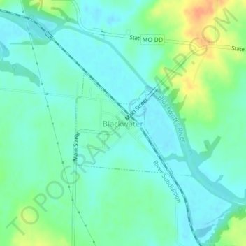
Name: Blackwater topographic map, elevation, terrain.
Location: Blackwater, Cooper County, Missouri, United States (38.97483 -92.99756 38.98592 -92.98362)
Average elevation: 195 m
Minimum elevation: 183 m
Maximum elevation: 223 m
Other topographic maps
Click on a map to view its topography, its elevation and its terrain.
Prairie Home
United States > Missouri > Cooper County > Prairie Home
Prairie Home, Cooper County, Missouri, United States
Average elevation: 263 m