Geolocate

Honscheid topographic map

Interactive map

Click on the map to display elevation.

About this map

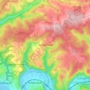
Name: Honscheid topographic map, elevation, terrain.

Location: Honscheid, Ruppichteroth, Rhein-Sieg-Kreis, Nordrhein-Westfalen, Deutschland (50.77058 7.36047 50.81058 7.40047)

Average elevation: 181 m

Minimum elevation: 73 m

Maximum elevation: 267 m

Honscheid liegt auf dem Nutscheid. Nachbarorte sind der Neuenhof, Stockum und die Weiler der Mertener Höhe.

Other topographic maps

Click on a map to view its topography, its elevation and its terrain.

Bornscheid

Deutschland > Nordrhein-Westfalen > Rhein-Sieg-Kreis > Ruppichteroth > Bornscheid

Bornscheid, Ruppichteroth, Rhein-Sieg-Kreis, Nordrhein-Westfalen, 53809, Deutschland

Average elevation: 227 m

Jünkersfeld

Deutschland > Nordrhein-Westfalen > Rhein-Sieg-Kreis > Ruppichteroth > Bröleck > Jünkersfeld

Jünkersfeld, Bröleck, Ruppichteroth, Rhein-Sieg-Kreis, Nordrhein-Westfalen, 53809, Deutschland

Average elevation: 187 m