
Houille topographic map
Interactive map
Click on the map to display elevation.
About this map
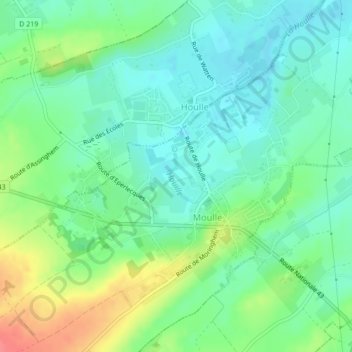
Name: Houille topographic map, elevation, terrain.
Average elevation: 21 m
Minimum elevation: 0 m
Maximum elevation: 65 m
Other topographic maps
Click on a map to view its topography, its elevation and its terrain.
Houille
France > Hauts-de-France > Pas-de-Calais > Moulle
Houille, Moulle, Saint-Omer, Pas-de-Calais, Hauts-de-France, France métropolitaine, 62910, France
Average elevation: 20 m