
Pakwach topographic map
Interactive map
Click on the map to display elevation.
About this map
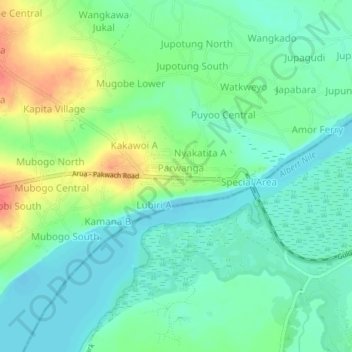
Name: Pakwach topographic map, elevation, terrain.
Location: Pakwach, Nebbi, Northern Region, Uganda (2.44090 31.47872 2.48090 31.51872)
Average elevation: 631 m
Minimum elevation: 613 m
Maximum elevation: 667 m
Other topographic maps
Click on a map to view its topography, its elevation and its terrain.