
City Park topographic map
Interactive map
Click on the map to display elevation.
About this map
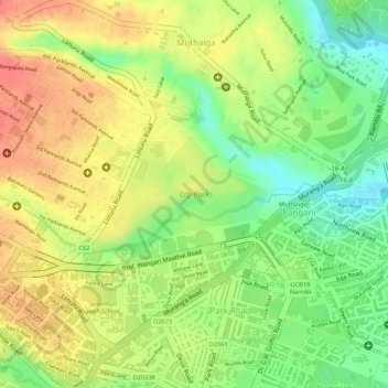
Name: City Park topographic map, elevation, terrain.
Location: City Park, Pangani, Nairobi, Kenya (-1.26767 36.82252 -1.25962 36.83517)
Average elevation: 1,665 m
Minimum elevation: 1,627 m
Maximum elevation: 1,695 m
Other topographic maps
Click on a map to view its topography, its elevation and its terrain.
Nairobi River
Nairobi River, Nairobi, P. O. BOX 66831, Kenya
Average elevation: 1,763 m
Central Park
Central Park, Upper Hill, Nairobi, Kenya
Average elevation: 1,687 m