
El Tigre topographic map
Interactive map
Click on the map to display elevation.
About this map
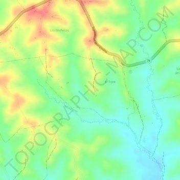
Name: El Tigre topographic map, elevation, terrain.
Location: El Tigre, Los Palmitos, Montes de María, Sucre, Colombia (9.41285 -75.23514 9.42380 -75.22062)
Average elevation: 210 m
Minimum elevation: 178 m
Maximum elevation: 249 m