
Mubuga topographic map
Interactive map
Click on the map to display elevation.
About this map
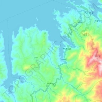
Name: Mubuga topographic map, elevation, terrain.
Location: Mubuga, Karongi, Western Province, Rwanda (-2.15468 29.27479 -2.05820 29.35921)
Average elevation: 1,607 m
Minimum elevation: 1,455 m
Maximum elevation: 2,265 m