
Gandesa topographic map
Interactive map
Click on the map to display elevation.
About this map
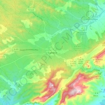
Name: Gandesa topographic map, elevation, terrain.
Location: Gandesa, Tierra Alta, Tarragona, Cataluña, 43780, España (41.01204 0.39890 41.09204 0.47890)
Average elevation: 389 m
Minimum elevation: 221 m
Maximum elevation: 690 m