
Limeira do Oeste topographic map
Interactive map
Click on the map to display elevation.
Limeira do Oeste
Limeira do Oeste belongs to the statistical micro-region of Frutal. It is located in the extreme west of the rich region of western Minas Gerais known as the Triângulo Mineiro at an elevation of 428 meters. Neighboring municipalities are.
About this map
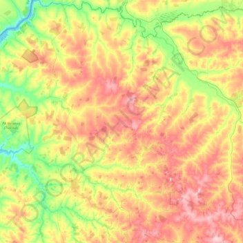
Name: Limeira do Oeste topographic map, elevation, terrain.
Average elevation: 428 m
Minimum elevation: 322 m
Maximum elevation: 542 m