
Thank you for supporting this site ❤️
Make a donation
Make a donation
Gear up for your next adventure:
As an Amazon Associate, this site earns from qualifying purchases at no extra cost to you.
Smelter topographic map
Click on the map to display elevation.
Thank you for supporting this site ❤️
Make a donation
Make a donation
Gear up for your next adventure:
As an Amazon Associate, this site earns from qualifying purchases at no extra cost to you.
About this map
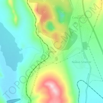
Name: Smelter topographic map, elevation, terrain.
Location: Smelter, Tinyahuarco, Provincia de Pasco, Pasco, Perú (-10.78560 -76.29347 -10.74560 -76.25347)
Average elevation: 4,239 m
Minimum elevation: 4,140 m
Maximum elevation: 4,455 m
Thank you for supporting this site ❤️
Make a donation
Make a donation
Gear up for your next adventure:
As an Amazon Associate, this site earns from qualifying purchases at no extra cost to you.