Geolocate

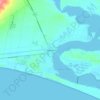
Milang topographic map

Click on the map to display elevation.

About this map

Name: Milang topographic map, elevation, terrain.

Location: Milang, Alexandrina Council, South Australia, 5256, Australia (-35.46578 138.88831 -35.34636 139.01494)

Average elevation: 8 m

Minimum elevation: -1 m

Maximum elevation: 38 m

Other topographic maps

Click on a map to view its topography, its elevation and its terrain.
Gear up for your next adventure:

🥾Walking Shoes - Lightweight walking shoes for countryside and coastal paths
⛺Lightweight Tents - Compact tents for backpacking and trekking
⌚Altimeter Watches - Watches measuring altitude for mountain activities
🥤Hydration Bladders - Hands-free hydration systems for backpacks
📕Outdoor Navigation Books - Learn traditional and modern navigation techniques

As an Amazon Associate, this site earns from qualifying purchases at no extra cost to you.