
Hagelsdorf topographic map
Interactive map
Click on the map to display elevation.
About this map
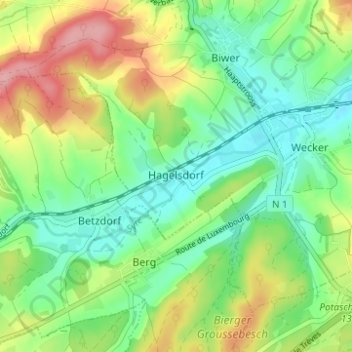
Name: Hagelsdorf topographic map, elevation, terrain.
Location: Hagelsdorf, Biwer, Canton Grevenmacher, 6838, Luxembourg (49.67259 6.34426 49.71259 6.38426)
Average elevation: 256 m
Minimum elevation: 209 m
Maximum elevation: 336 m