
Baghar topographic map
Interactive map
Click on the map to display elevation.
About this map
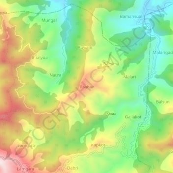
Name: Baghar topographic map, elevation, terrain.
Location: Baghar, Lamgara Tehsil, Almora, Uttarakhand, 263625, India (29.54118 79.74739 29.58118 79.78739)
Average elevation: 1,622 m
Minimum elevation: 1,373 m
Maximum elevation: 1,955 m