Geolocate

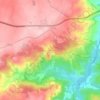
Freineda topographic map

Click on the map to display elevation.

About this map

Name: Freineda topographic map, elevation, terrain.

Location: Freineda, Almeida, Guarda, Portugal (40.55081 -6.93402 40.59861 -6.83679)

Average elevation: 755 m

Minimum elevation: 581 m

Maximum elevation: 833 m

Other topographic maps

Click on a map to view its topography, its elevation and its terrain.
Castelo Mendo

Portugal > Guarda > Almeida

Average elevation: 722 m

Jardo

Portugal > Guarda > Almeida

Average elevation: 721 m

Pailobo

Portugal > Guarda > Almeida > Pailobo

Average elevation: 773 m

Castelo Mendo

Portugal > Guarda > Almeida

Average elevation: 722 m

Gear up for your next adventure:

📷Camera Straps - Secure straps for carrying cameras while walking
👟Women's Trail Running Shoes - Agile footwear for fell running and technical trails
🥤Collapsible Water Bottles - Save space in your rucksack as you consume your water
🦯Walking Poles - Supportive poles for long-distance walking
🗺️Scratch-off Peak Maps - Track your progress climbing Munros or Wainwrights

As an Amazon Associate, this site earns from qualifying purchases at no extra cost to you.