
Lolland Municipality topographic map
Interactive map
Click on the map to display elevation.
About this map
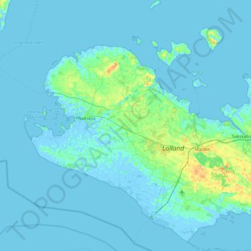
Name: Lolland Municipality topographic map, elevation, terrain.
Location: Lolland Municipality, Region Zealand, Denmark (54.59375 10.95471 55.04052 11.58169)
Average elevation: 2 m
Minimum elevation: -6 m
Maximum elevation: 25 m
Other topographic maps
Click on a map to view its topography, its elevation and its terrain.