Château-Chinon (Ville) topographic map
Interactive map
Click on the map to display elevation.
About this map
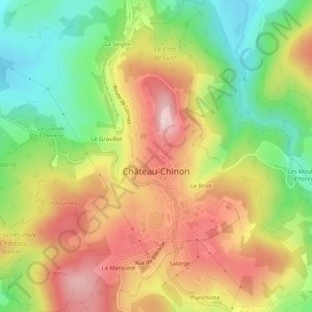
Name: Château-Chinon (Ville) topographic map, elevation, terrain.
Average elevation: 470 m
Minimum elevation: 342 m
Maximum elevation: 600 m

Click on the map to display elevation.
Name: Château-Chinon (Ville) topographic map, elevation, terrain.
Average elevation: 470 m
Minimum elevation: 342 m
Maximum elevation: 600 m