Geolocate

Madaguing topographic map

Click on the map to display elevation.

About this map

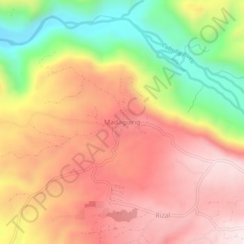
Name: Madaguing topographic map, elevation, terrain.

Location: Madaguing, Misamis Oriental, Northern Mindanao, Philippines (8.65006 124.85843 8.69006 124.89843)

Average elevation: 603 m

Minimum elevation: 216 m

Maximum elevation: 890 m

Gear up for your next adventure:

🐕Dog Hiking Gear - Equipment for hiking safely with dogs
🗺️Topographic Maps - Detailed maps showing elevation and terrain features
👕Merino Base Layers - Natural temperature regulation for cold weather hiking and camping
🧷Tenacious Repair Tape - Instant fix for torn tents, jackets, or dry bags
🛑Emergency Bivvy Bags - Heat-reflective survival bags for unexpected nights out

As an Amazon Associate, this site earns from qualifying purchases at no extra cost to you.