
Vincourt topographic map
Interactive map
Click on the map to display elevation.
About this map
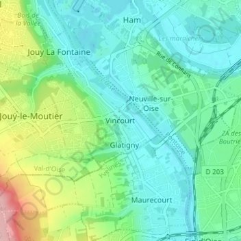
Name: Vincourt topographic map, elevation, terrain.
Average elevation: 56 m
Minimum elevation: 17 m
Maximum elevation: 170 m
Other topographic maps
Click on a map to view its topography, its elevation and its terrain.
Glatigny
France > Île-de-France > Val-d'Oise > Jouy-le-Moutier
Glatigny, Jouy-le-Moutier, Pontoise, Val-d'Oise, Île-de-France, France métropolitaine, 95280, France
Average elevation: 59 m