
Laurel topographic map
Interactive map
Click on the map to display elevation.
About this map
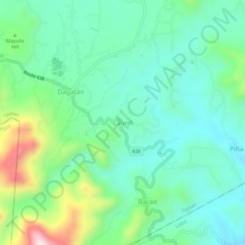
Name: Laurel topographic map, elevation, terrain.
Location: Laurel, Taysan, Batangas, Calabarzon, Philippines (13.71031 121.18824 13.75031 121.22824)
Average elevation: 192 m
Minimum elevation: 70 m
Maximum elevation: 533 m