
Loch Ashie topographic map
Interactive map
Click on the map to display elevation.
About this map
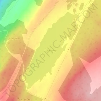
Name: Loch Ashie topographic map, elevation, terrain.
Location: Loch Ashie, Inverness, Highland, Scotland, United Kingdom (57.37288 -4.29502 57.39367 -4.26800)
Average elevation: 228 m
Minimum elevation: 125 m
Maximum elevation: 284 m
Other topographic maps
Click on a map to view its topography, its elevation and its terrain.