
Bullas topographic map
Interactive map
Click on the map to display elevation.
About this map
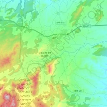
Name: Bullas topographic map, elevation, terrain.
Location: Bullas, Noroeste, Region of Murcia, 30180, Spain (37.96552 -1.72245 38.09592 -1.61518)
Average elevation: 643 m
Minimum elevation: 433 m
Maximum elevation: 1,221 m
Other topographic maps
Click on a map to view its topography, its elevation and its terrain.
Arroyo Tercero
Spain > Region of Murcia > Noroeste > Moratalla > Arroyo Tercero
Average elevation: 1,203 m