
Thank you for supporting this site ❤️
Make a donation
Make a donation
Gear up for your next adventure:
As an Amazon Associate, this site earns from qualifying purchases at no extra cost to you.
Mekeri topographic map
Click on the map to display elevation.
Thank you for supporting this site ❤️
Make a donation
Make a donation
Gear up for your next adventure:
As an Amazon Associate, this site earns from qualifying purchases at no extra cost to you.
About this map
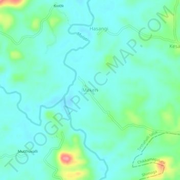
Name: Mekeri topographic map, elevation, terrain.
Location: Mekeri, Tirthahalli taluk, Shimoga, Karnataka, India (13.51528 75.17441 13.55528 75.21441)
Average elevation: 634 m
Minimum elevation: 611 m
Maximum elevation: 718 m
Thank you for supporting this site ❤️
Make a donation
Make a donation
Gear up for your next adventure:
As an Amazon Associate, this site earns from qualifying purchases at no extra cost to you.