Geolocate

Champsec topographic map

Interactive map

Click on the map to display elevation.

About this map

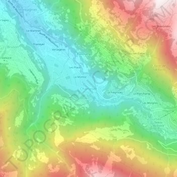
Name: Champsec topographic map, elevation, terrain.

Location: Champsec, Val de Bagnes, Entremont, Wallis, 1934, Switzerland (46.03676 7.22324 46.07676 7.26324)

Average elevation: 1,344 m

Minimum elevation: 825 m

Maximum elevation: 2,183 m

Other topographic maps

Click on a map to view its topography, its elevation and its terrain.

Bourg-Saint-Pierre

Switzerland > Wallis > Entremont

Average elevation: 2,530 m

Val Ferret

Switzerland > Wallis > Entremont > Orsières

Average elevation: 2,026 m

Val de Bagnes

Switzerland > Wallis > Entremont

Average elevation: 2,321 m

Val de Bagnes

Switzerland > Wallis > Entremont

Average elevation: 2,321 m

Liddes

Switzerland > Wallis > Entremont

Average elevation: 2,123 m