
Dorchester topographic map
Interactive map
Click on the map to display elevation.
About this map
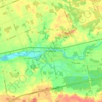
Name: Dorchester topographic map, elevation, terrain.
Location: Dorchester, Middlesex County, Ontario, N0L 1G2, Canada (42.94869 -81.09870 43.02869 -81.01870)
Average elevation: 271 m
Minimum elevation: 244 m
Maximum elevation: 298 m