
Thank you for supporting this site ❤️
Make a donation
Make a donation
Gear up for your next adventure:
As an Amazon Associate, this site earns from qualifying purchases at no extra cost to you.
Pendyala topographic map
Click on the map to display elevation.
Thank you for supporting this site ❤️
Make a donation
Make a donation
Gear up for your next adventure:
As an Amazon Associate, this site earns from qualifying purchases at no extra cost to you.
About this map
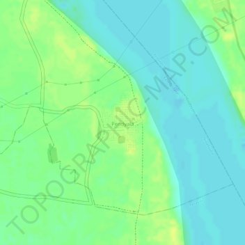
Name: Pendyala topographic map, elevation, terrain.
Location: Pendyala, Nidadavole, East Godavari, Andhra Pradesh, India (16.85899 81.74247 16.86544 81.74839)
Average elevation: 12 m
Minimum elevation: 3 m
Maximum elevation: 23 m
Thank you for supporting this site ❤️
Make a donation
Make a donation
Gear up for your next adventure:
As an Amazon Associate, this site earns from qualifying purchases at no extra cost to you.