
Thank you for supporting this site ❤️
Make a donation
Make a donation
Gear up for your next adventure:
As an Amazon Associate, this site earns from qualifying purchases at no extra cost to you.
Kersa topographic map
Click on the map to display elevation.
Thank you for supporting this site ❤️
Make a donation
Make a donation
Gear up for your next adventure:
As an Amazon Associate, this site earns from qualifying purchases at no extra cost to you.
About this map
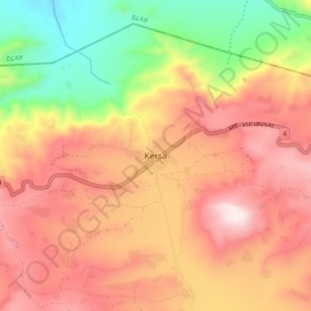
Name: Kersa topographic map, elevation, terrain.
Location: Kersa, East Harerghe, Oromia Region, Ethiopia (9.41500 41.82639 9.49500 41.90639)
Average elevation: 1,933 m
Minimum elevation: 1,469 m
Maximum elevation: 2,302 m
Thank you for supporting this site ❤️
Make a donation
Make a donation
Gear up for your next adventure:
As an Amazon Associate, this site earns from qualifying purchases at no extra cost to you.